Keno's Home and Crestone's Official Weather Station
Crestone, Colorado
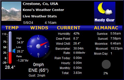
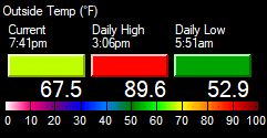
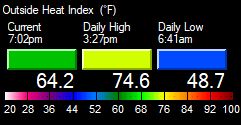
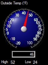
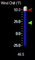
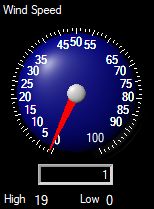
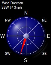
Local Weather Conditions
Updated every 10 Minutes
[Click on Refresh/Reload to Update Page]
Latitude: N 37.98 Longitude: W -105.68 Elevation: 8085 Feet
|
  |
|
|
|
|
|
|
|
 |
   |
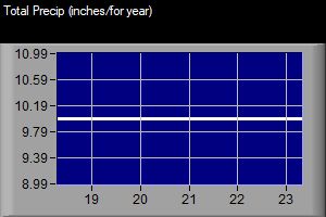
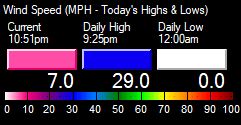
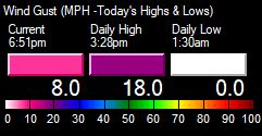
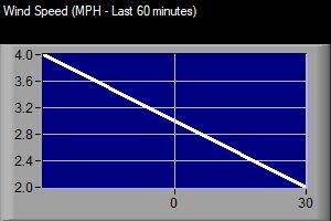
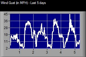
- Current Graphs - |
|
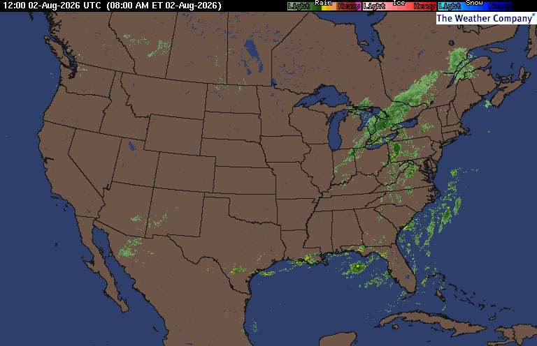
- Weather Conditions Nearby -
-
Click on
HERE for Colorado conditions elsewhere -
(See this
notice about these conditions)
![]() 30 Day
& 8 to 14 Day Outlooks /
Current
Drought info
30 Day
& 8 to 14 Day Outlooks /
Current
Drought info![]()
(From the NWS, updated at different times)
- Local Forecast -
(Updated: 610 AM MDT on August 2)
![]() A Rare HEAT ADVISORY Issued for our area for
locations below 8,500 feet
A Rare HEAT ADVISORY Issued for our area for
locations below 8,500 feet ![]()
Today Mostly Sunny Hot!...Record High High 92°F |
Tonight Partly Cloudy Warm Low 57°F |
Monday AM Sunny/Hot again Rec High/PM Rn? High 92°F |
Monday Night Early Tstm? Mostly Clear Low 57°F |
Tuesday AM Mostly Sunny PM Chance Tstm High 89°F
Tuesday | Night Early Tstm? Partly Cloudy, late Low 54°F
Wednesday | Mostly Sunny PM T-Stm? High 88°F
Wednesday | Night Mostly Clear Low 54°F
Thursday |  Mostly Sunny High 89°F |
|
Weather Info
Forecast below is for the entire area, forecast above is
for around 8,000 feet only.... The normal high temperature today
around the Crestone/Baca area is 81°, record high is 91°,
the normal low is 50°, record low is
40°.
Click
here for the latest
Colorado Forecast Maps, and more.
Today
Mostly sunny... Hot, with record highs likely
below 10,000 feet of 86° to 94°, and with warm highs above
10,000 feet of 64° to 76°... Light and variable wind becoming
east northeast 5 to 15 mph in the afternoon.
Partly cloudy...
Mild to warm low temps below 10,000 feet of 54°
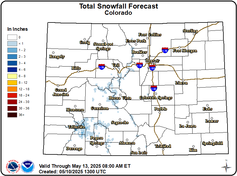
Chances for Measurable Precip
(thru Thursday)
Click on Image to Enlarge
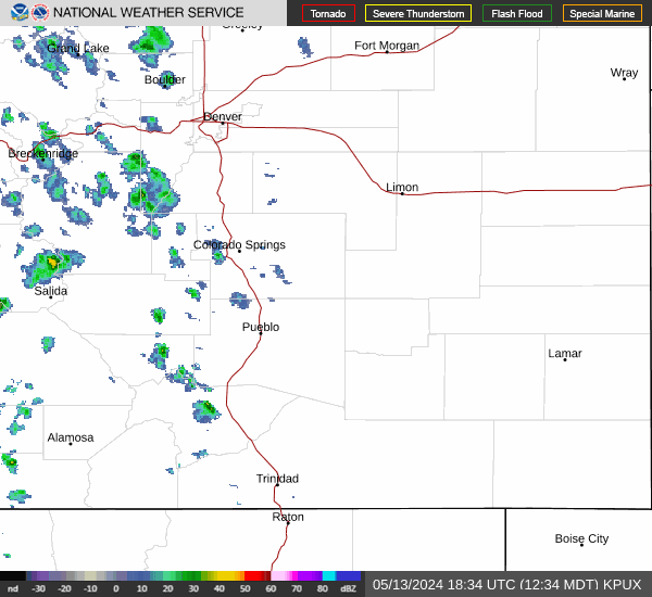
Click
on Image for more Monarch Pass cams
Click
on Image for more Wolf Creek Pass cams
Click on Image for more Poncha Pass cams
Click on Image for more
La Veta Pass cams
Welcome to my home weather station. The station's
stats are recorded online every 6 to 10 minutes, 24 hours a day. My first
weather station went online back in 1999, when I lived in Manitou Sps, CO.
My second internet station went online in
2001, and began to collect data for Crestone, CO; in
November, 2002, it became Crestone's official weather station in
2006. This current online station started up in August of 2019.
(You can read more on this
here).
Please feel free to
email me with any comments you
might have. Keno
If you would like to help support the Crestone
Weather Center with a donation, you can do so by clicking below:
- More Crestone Weather Info -
| |||||||||||||||||||||||||