Colorado Web Cams
Wolf Creek Pass, Colorado
(Note: This page may need reloading on some browsers for new views)
Wolf Creek Pass
is located in southern Colorado, on US Highway 160, to the west of the Wolf
Creek Ski Area. At an elevation 10,857 feet / 3,310 meters, the pass sits directly on
the Continental Divide of the Americas. The pass is significantly steep
on either side (6.8% maximum grade) and can be dangerous in winter.
There are two runaway truck ramps on the westbound side for truckers in
case they lose control of their brakes. A 900-foot (270 meter) tunnel on the eastern portion was opened November 5, 2005,
built to improve safety and navigation in the snowy winter months. Wolf Creek Pass is one of the
snowiest places in Colorado and America, averaging 436 inches / 1,107 centimeters of snow per
year, and busy US 160 is sometimes forced to closed in winter due to the
heavy snowfall.
Wolf Creek Pass has a subarctic climate with substantial precipitation year-round, having a different climate than other climates on a similar latitude due to its high elevation. Summer usually consists of mild days and chilly nights. Winter consists of cold days with nightly lows close to zero lasting from early November to sometimes into April. Snowfall usually starts up by late September and doesn't cease until early June. March averages the highest snowpack of the year at 67 inches (170 centimeters), while the pass recorded its record-breaking 807 inches of snow during the 1978-1979 season. The official Wolf Creek Weather Station reports the coldest temperature reading at −40°F / −33°C, set in December, 1982, while its warmest day and record high on the pass was 82°F / 28°C, set on July 10, 2003.
The pass was named for Wolf Creek, which starts near the top of the pass and flows down its western side to a confluence with the West Fork San Juan River in Mineral County. There's a lot here for visitors to see on top of the pass. The main route of the Continental Divide Trail (CDT), which reaches from Mexico to Canada, passes through Wolf Creek Pass. North bound "thru hikers" usually hike through Wolf Creek Pass in June. No question, this pass is an attraction for tourists, thanks to the natural beauty of the wilderness that the highway passes through. Just west of the pass, Treasure Falls offers passersby a view of a mountain waterfall. The pass is also home to Wolf Creek Ski Area, found on the eastern side of the Continental Divide on Highway 160. Finally, the Lobo Overlook, at 11,770 feet (3,588 meters) elevation on the north side of the pass, provides commanding views of the Continental Divide.

Wolf Creek Pass 1, by ski area
(at US Hwy 160 - east bound)

Wolf Creek Pass 2, near ski area
(at US Hwy 160 - west bound)
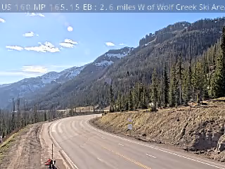
US 160 near top of Pass, 2.6 miles West of Wolf Creek Ski Area
- Cams Offline -
Wolf Creek Pass 4 / Wolf Creek Pass 5
(near and at tunnel)
- These cams were removed by CDOT** -
**CDOT have once again removed 2 very important pass webcams... as the 2 cams that were up above, the only 2 cams at the very top of this pass, are gone! Please call and ask them to return these important cams asap! The main customer service number for CDOT is (303) 757-9011.
- Map -
| Colorado Web Cams | Cumbres Pass | Creede | Pagosa Springs | South Fork | Crestone Weather Center |