View of the Spanish Peaks (looking north)
(all cams come from Coloradowebcam.net)
Colorado Web Cams
Weston/Spanish Peaks, Colorado
Weston is a hamlet located in southern Colorado on the Highway of Legends Byway west of Trinidad in Las Animas County, which borders New Mexico. The tiny town had a population of 53 residents in 2020.
Weston sits in the Purgatoire River Valley, surrounded by wildlife areas at an elevation of 6,880 feet (2,097 meters). Colorado State Highway 12 passes through the community, leading east (downriver) 22 miles (35 km) to Trinidad, the county seat, and west 11 miles (18 km) to Stonewall Gap.
The town features a semi-arid climate. Winters are cold and typically dry with daily temperatures averaging in high in the upper 30s (°F), dropping to average lows in the mid-to-high teens. Summers are warm and pleasant, with afternoon temperatures routinely climbing into the low 80s (°F). Weston receives around 23 inches (58.4 centimeters) of precipitation annually, including an average annual snowfall of around 69 inches (175 centimeters).
The Spanish Peaks are a pair of mountains located north of Weston, located in southwestern Huerfano County. The Ute Indians named them Huajatolla (pronounced Wa-ha-toy-a), meaning "two breasts" or "breasts of the Earth". The two peaks, West Spanish Peak (13,629 feet/4,156 meters) and East Spanish Peak (12,688 feet/3,871 meters), are east of, and separate from, the Culebra Range of the Sangre de Cristo Mountains. Culebra Range's highest point is Culebra Peak (14,047 feet/4,282 meters), which is notable for being the only fourteener in Colorado which is located on private land and is the most southern 14er in the U.S.
The two peaks are a designated U.S. National Natural Landmark, internationally famous for over 500 radiating "dikes" - walls of hardened volcanic rock that slice through the surrounding landscape.
(Note: This page may need reloading on some browsers for new views)
View of the Spanish Peaks (looking
north)
(all cams come from
Coloradowebcam.net)
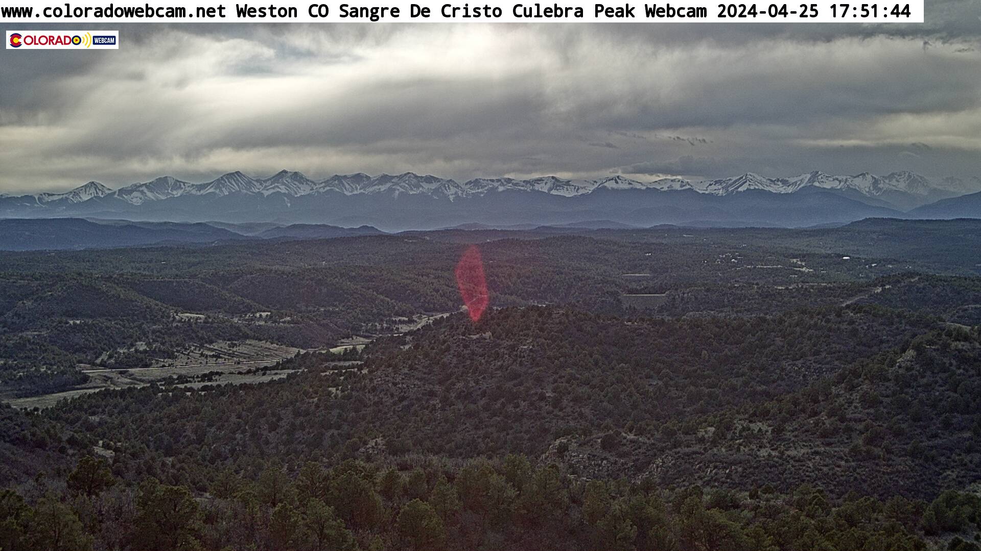
Sangre de Cristo Mountains
East side by Culebra Range
and looking west from Weston.

East Fisher’s Peak
at 9,633-feet [2,936 m]
- Map -
| Colorado Web Cams | Trinidad | Cuchara | Crestone Weather Center |