
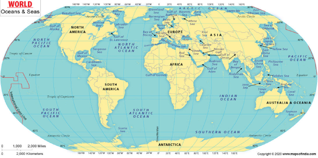
- Oceans -
Worldwide Webcams
- Oceans -
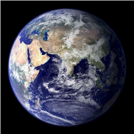
Our oceans cover 70.8% of planet Earth. The term ocean (in English) refers to any of the large bodies of water into which the world ocean is conventionally divided. The following are the five different areas of the ocean: Pacific, Atlantic, Indian, Antarctic (or Southern), and Arctic. The ocean is a body on salt water, and contains 97% of Earth's water; thus the ocean is essential to life on Earth. The ocean influences climate and weather patterns, the carbon cycle, and the water cycle by acting as a huge heat reservoir.
First, we have cams from a few beaches, ships at sea and underwater cams:
This is a Polar research ship operated by Britain which travels on the Arctic, Atlantic and Antarctic Oceans; her present location is noted up on top of the image. The ship is about 125 meters (410 ft) long, with a beam of about 24 meters (79 ft). The draught is about 7 meters (23 ft) with a cruising speed of 13 knots (24 km/h; 15 mph) with a range of 19,000 nautical miles (35,000 km; 22,000 mi) at that speed. She is capable of carrying two helicopters and has a capacity for approximately 900 cubic meters (32,000 cu ft) of cargo. Accommodation is provided for 30 crew and 60 research staff. Sir David Attenborough began her sea trials on 21 October 2020. She officially made her maiden voyage to Antarctica on 16 November 2021.
Bonaire Coral Reef, Caribbean, Atlantic Ocean
(From Harbour Village Bonaire)
Bonaire (/bɒˈnɛər/ bon-AIR, Dutch: [boːˈnɛːr(ə)]; is a Caribbean island in the Leeward Antilles, and is a public body of the Netherlands, in the ABC Islands. The Bonaire National Marine Park or BNMP is one of the oldest marine reserves in the world. It includes the sea around Bonaire and Klein Bonaire from the high water line to a depth of sixty meters (200 feet). The park was established in 1979 and covers 2700 hectares (6700 acres) and includes a coral reef, seagrass, and mangrove vegetation.
The flora and fauna of the open water off the coast of Bonaire are not well researched. The water is quite warm and contains few natural nutrients, but large quantities of phytoplankton live in this area. Large fish occasionally observed in this area include tuna, wahoo, marlin and swordfish. Also whale sharks have already been spotted in the waters. In addition, countless invertebrates such as shrimp, crayfish and squid, surgeonfish, parrotfish, reefperch and wrasses live here.
The Reef (as all reefs in this area) is threatened by the effects of pollutants and the warming of the sea from climate change.
The camera is located at the entrance of Harbour Village Marina at a depth of 5m / 16ft. Generally, it moves on its preset tour with 6 chosen views. The camera is also manually operated when its operators are able to do so. The two domes you see were setup in 2015, in a reef restoration experiment that wapartnered with the Harbour Village Reef Foundation and a local group called the Junior Rangers.
Underwater Ocean Cam, Atlantic Ocean
(From City of Deerfield Beach)
From the Deerfield Beach (Florida) fish cam, this underwater camera is located at the bottom of the ocean off of the International Fishing Pier. It helps to show the natural elements of the sea from heavy wind, strong current, storms and heavy rain, and substantial wave action due to its location in a high surf zone. This cam allows viewers to watch a myriad of different fish species as they swim in the ocean currents.
Off Keahole Point, Pacific Ocean
(From YouTube and MEGA
Cam)
Keāhole Point is located at the westernmost point of the island of Hawaii. The carma is operated by The MEGA Lab, in Hilo Bay, whose people use new technology that protects the nearby ocean and provide it to its communities that need it the most. They specializes in the changing climate, ocean ecology and the molecular connections humans have with nature.
Huntington Beach Pier,
Pacific Ocean
(from
City of Huntington Beach)
Measuring 1,850 feet (564 meters) in length, the iconic landmark Huntington Beach Pier in California, is one of the longest piers on the West Coast. Jutting out into the Pacific Ocean at the intersection of Main Street and Pacific Coast Highway, it symbolizes the heart of Huntington Beach (aka “Surf City, U.S.A.).
Pipeline Cam, Oahu, Ehukai Beach, Hawaii, USA, Pacific Ocean
(From Explore Oceans)
The famous Banzai Pipeline, on the north shore of Oahu at Ehukai Beach. Panning from left to right, this live cam provides the best visual surf report for one of the most popular surfing destinations in the world.
Utopia Village Top-of-Wall Underwater Reef Cam, Honduras
(from Explore Oceans)
Utopia Village is located on the south shore of Utila, the smallest of the Bay Islands, off the northern coast of Honduras in the western Caribbean.
Camera is installed 400 ft from shore at a depth of 25 ft, on the top of a steep reef wall that drops 120 ft to the ocean floor below.
Look out for schools of smaller fish like Wrasse, Sergeant Majors and Trumpetfish.
- Next up, Cams from Gulfs, Bays, Seas or Coves -
Yes, Gulfs, Bays and Coves are all considered parts of Oceans.
Hauraki Gulf, Auckland, New Zealand
(From Hauraki Gulf Weather)
Located on the south west corner of the Hauraki Gulf at the entrance of the Waitemata harbour. The Hauraki Gulf is off of the North Island of New Zealand. This Gulf is a part of the Pacific Ocean, which it joins to the north and east, and has an area of 4,000 kilometers/2,486 miles. Most of the gulf is part of the Hauraki Gulf Marine Park and lies between, the Auckland Region, the Hauraki Plains, the Coromandel Peninsula, and Great Barrier Island.
The gulf is a vibrant natural environment, which has seen significant damage during the 20th and early 21st century from human use, that is still worsening (or at best, stable) at problematic levels. Voluntary coast clean-up groups are working to solve this problem. Some particular common or known animals that live here include bottlenose and common dolphins, orcas, cetaceans, and many different kinds of whale species.
Monterey Bay,
California, USA
(from
Monterey Bay Aquarium)
This cam comes from the Monterey Bay Aquarium's ocean-view decks. From this vantage point, you can identify a number of the birds and sea mammals that find refuge in the coastal waters of Monterey Bay. Monterey Bay is part of the Monterey Bay National Marine Sanctuary, a federally protected marine area offshore of California's central coast. This safe haven is home to a rich variety of fishes, plants, marine mammals and birds. Watch the cam and enjoy the rich Life on the Bay. Please Donate or join the Aquarium here!
Anacapa Island Cove, California, USA
(From
Channel Islands National Park)
Anacapa Island is 11 miles off the coast of Ventura, California. You can only access this Island from the Channel Islands Harbor. It is the smallest of the northern islands of the Channel Islands, and it seems to change shape in the summer fog or afternoon heat, the three islets of Anacapa look like an island of deception or a mirage. Almost five miles long, these islets (appropriately named East, Middle, and West Anacapa Islands) are inaccessible from each other except by boat. They have a total land area of about one square mile (700 acres). Waves have eroded the volcanic island, creating towering sea cliffs, sea caves, and natural bridges, such as forty-foot-high Arch Rock-a symbol of Anacapa and Channel Islands National Park.
Crystal Bay at
Bay Beach Resort, Choeng Mon Beach,
Koh Samui, Thailand
(From The
Real Samui)
Crystal Bay, aka Silver Beach, is a bay between Chaweng Beach and Lamai Beach. Crystal Bay is a 250 meter/820 feet long bay dotted with large boulders. The palm trees and green hills complete the tropical picture. The seawater in the bay is clear and there are some colourful fish to be found.
Nordkapp Havfiske, North Cape, Norway
(From
NorthCape Seafishing)
The Barents Sea is a sea of the Arctic Ocean, located off the northern coasts of Norway and Russia and divided between Norwegian and Russian territorial waters. The Sea is a rather shallow shelf sea with an average depth of 230 metres (750 ft). Barents Sea is the fastest-warming part of the Arctic, and some assessments now treat Barents sea ice as a separate tipping point from the rest of the Arctic sea ice, suggesting that it could permanently disappear once the global warming exceeds 1.5 degrees Celsius (equivalent to 2.7 degrees Fahrenheit).
North Cape, gets significant snow, with winter months seeing consistent snow cover, heavy winds, and road closures, averaging a maximum depth of around 58 cm (23 inches) but often much deeper under harsh winter conditions, with February typically seeing the most snowfall. Expect snow from late autumn (November) through spring (May/June), requiring convoy access and warm gear due to Arctic conditions and strong winds. Winter averages temperatures are around -3°C (27°F) but feels much colder with wind chill, dropping to -15°C (5°F) or lower.
Summer in North Cape, Norway, means experiencing the magical Midnight Sun (May-July) with endless daylight, mild but windy weather (temps around 10°C/50°F average, so a warm jacket, hat, and gloves are essential due to the wind and cool temperatures, despite the summer season). But with vibrant nature to explore, it's perfect for hiking or watching reindeer, all while enjoying cool, bright Arctic scenery.
The location shown above is the Kamøyfjord in the Nordkapp municipality with the fishing village of Kamøyvær located at the innermost part of the fjord. The 14-kilometre (8.7 mi) long fjord runs from the Barents Sea southwest with two smaller fjords that branch off: the Skipsfjorden flowing to the south and the Duksfjorden flowing to the west. Nordkapp Sea Fishing has a catch guarantee - if you have not caught any fish in their boat during a stay of at least 24 hours, you will pay nothing for your stay and boat rental. See more on this here: https://nordkapphavfiske.com/
Mediterranean Sea, Elysium Resort, Rhodes, Greece
(From
Elysium Resort & Spa)
Rhodes (/roʊdz/; Greek: Ρόδος, romanized: Ródos [ˈroðos]) is the largest of the Dodecanese islands of Greece and is their historical capital; it is the ninth largest island in the Mediterranean Sea (/ˌmɛdɪtəˈreɪniən/ MED-ih-tə-RAY-nee-ən). The Mediterranean Sea is a sea connected to the Atlantic Ocean, surrounded by the Mediterranean Basin and almost completely enclosed by land: on the north by Southern Europe and Anatolia, on the south by North Africa, on the east by the Levant in West Asia, and on the west almost by the Morocco–Spain border.
La Concha Beach, San Sebastian, Spain
(From VISION DIGITAL)
La Concha Beach is one of the most iconic beaches in San Sebastian, in the Basque Country, Spain. With its shell shape and golden sand, it is famous for its natural beauty and picturesque surroundings. The beach is surrounded by hills and offers spectacular views of the bay and Santa Clara Island. It is an ideal place to enjoy outdoor activities such as swimming, sunbathing and water sports. In addition, it has a promenade where you can find bars and restaurants offering delicious pintxos and other typical dishes from the region.
- Map -
| Worldwide Webcams Home Page | Colorado Web Cams | New York Webcams | New York City Webcams | Long Island |