
- Canada Webcams -
Worldwide Webcams
- Canada Webcams -
Canada is located in North America. It has ten provinces and three territories and extends from the Atlantic Ocean to the Pacific Ocean and northward into the Arctic Ocean, making it the world's second-largest country by total area (after Russia), along with the world's longest coastline. Its border is with the United States, and is the world's longest international land border. It is a sparsely inhabited country of just over 41 million people, with the vast majority residing south of the 55th parallel in urban areas. Canada's capital is Ottawa and its three largest metropolitan areas are Toronto, Montreal, and Vancouver. The country is a Commonwealth realm and is officially bilingual in the federal jurisdiction, while French and English are its official languages. But it's one of the world's most ethnically diverse and multicultural nations, thanks to large-scale immigration. Canada's long and complex relationship with the United States has had a significant impact on its history, economy, and culture.
The 2021 Canadian census enumerated a total population of 36,991,981, an increase of around 5.2 percent over the 2016 figure. It is estimated that Canada's population surpassed 40,000,000 in 2023. The main drivers of population growth are immigration and, to a lesser extent, natural growth. About 80 percent of the population lives within 150 kilometers (93 mi) of the border with the contiguous United States. Canada sees over 80 percent of its population living in urban centers. The most densely populated part of the country, which accounts for nearly 50 percent of the population, is the Quebec City–Windsor Corridor in Southern Quebec and Southern Ontario along the Great Lakes and the St. Lawrence River.
Climate wise, because of units location on Earth, it's mainly a cold place. Average winter and summer high temperatures across Canada vary from region to region. Winters can be harsh in many parts of the country, particularly in the interior and Prairie provinces, where daily average temperatures are near −15°C (5°F), but can drop to below −40°C (−40°F) with severe wind chills. The coldest temperature ever recorded in North America happen in Canada, in Snag, Yukon, where the temp dropped to -63° C (-81.4°F). The coldest place in Canada based on average yearly temperature is Eureka, Nunavut, where the temperature averages at −19.7°C or −3.5°F for the year. Coastal British Columbia is the country's warmest area, and normally sees a mild and rainy winter. On the east and west coasts, average high temperatures are generally in the low 20s°C (70s°F), while between the coasts, the average summer high temperature ranges from 25 to 30°C (77 to 86°F), with temperatures in some interior locations occasionally exceeding 40°C (104°F).
Snowfall wise, Canada is the second snowiest country on Earth (Japan is first). Canada's annual average total is 3.5 meters (141 inches). The highest average yearly snowfall in Canada, falls in Woody Point, Newfoundland, averaging more than 6.4 meters (21 feet or 251 inches) of snow every winter. Forest Montmorency, Quebec is a close second, with annual totals around 6.1 meters (20 feet). British Columbia’s mountains receive even higher totals. In non-coastal regions, snow can cover the ground for almost six months of the year, while in parts of the far north, snow can persist year-round, with its farthest northern regions covered by ice and permafrost.
Note: This page may need reloading on some browsers for new cam views)
- Newfoundland -
St. John's Harbour, Newfoundland, Canada
(from CBC News NL)
The Canadian Broadcasting Corporation, branded as CBC/Radio-Canada, is the Canadian public broadcaster for both radio and television. It is a Crown corporation that serves as the national public broadcaster, with its English-language and French-language service units known as CBC and Radio-Canada, respectively.
CBC
provides a complete 24-hour network schedule of news, sports, entertainment, and children's programming; in most cases, it feeds the same programming at the exact local times nationwide, except to the Newfoundland Time Zone, where programs air 30 minutes late.

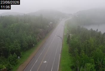
Daniel's Harbour, Newfoundland/Labrador, Canada
(from Newfoundland Labrador)
Daniel's Harbour is a community on the west coast of Newfoundland, in the province of Newfoundland and Labrador. Its population as reported by the 2021 Census was 220 people. It has a reputation as a great place for wild whale sightings. With a land area of 7.68 km2 (2.97 sq mi), it had a population density of 28.6/km2 (74.2/sq mi) in 2021.
Daniel's Harbour has a subarctic climate with June temperatures often under 10°C (50°F) due to extreme seasonal lag caused by the cold Labrador Current. Summers are cool to mild while winters are freezing cold. Precipitation is heavy year round, though less heavy during the spring. The highest temperature ever seen here was 28°C (50°F) and the all time record low is -39.4°C (-39.9°F). The area experiences a snowy winter season spanning about 6.4 months (from late October to early May). The town receives a moderate-to-heavy average annual snowfall of roughly 200 to 250 centimeters (78.7 to 98.4 inches).
- Québec -
Rue Lapointe (street), route 245 Eastman, Québec, Canada
(This cam and the next 2 below from Quebec 511)
Eastman is a resort municipality located in the Memphrémagog Regional County Municipality, nestled within the picturesque Eastern Townships of Quebec, Canada. Renowned for its rich cultural scene, natural landscapes at the foot of Mount Orford, and world-class Nordic spas, it serves as a premier wellness and outdoor destination. Its population in 2021 was 2,279, and its total area covers 77.10 km2 (29.77 sq. mi). Its mother tongue is French, as 92% of the locals speak it only. (just 4% speak English only; 1% both and 2% other languages). Annual snowfall here is 156 centimeters (61 inches).
Route 132 at Mont-Saint-Pierre, Québec, Canada
Mont-Saint-Pierre (elevation 430 meters / 1,411 feet), located in the Gaspésie region of Quebec, Canada, is a premier four-season ecotourism and free-flight destination. Nestled between the Chic-Chocs mountains and the St. Lawrence River, the village is famous for its glacial amphitheater and is internationally renowned as the capital of free flight in Eastern Canada and well known for hang-gliding and paragliding. Other activities offered: Hiking, snowshoeing, snowmobiling, ice climbing and backcountry skiing.
Settled 1858,
its population in 2021 was 186. The area features a subarctic climate strongly influenced by the Gulf of Saint Lawrence. It experiences short, mild summers, very cold, snowy winters, and consistently wet weather throughout the year.
Average annual snowfall of about 330 centimeters (130 inches at lower elevations,
with 400 to 800 centimeters (158 to 315 inches ) at the peaks.
Rue du Bateau-Passeur (Route 138), Tadoussac, Québec,Canada
| Tadoussac is a village of 800 , sitting on a
bay, situated in the North Shore tourist region of Quebec at the
maritime junction of the St. Lawrence River and the Saguenay Fjord
(inlet). The entire area is either rural or still in a wilderness state, with several federal and provincial natural parks and preserves nearby which protect natural resources.
The French maritime explorer Jacques Cartier came to the site in 1535 during
a voyage and found Innu people using it as a base for hunting seal; he
in turn open up major trading in the region, and the town was founded in
1599. Its population in 2021 was 814 and it has a total area of
200.11 km2 (77.26 sq. mi)
with only 52.73 km2 (20.36 sq. mi) of that land. 96% of the locals here
speak French as their first language. Tadoussac experiences a subarctic to humid continental climate characterized by short, pleasant summers (average July temp of 20°C / 68°F) and long, very cold, snowy winters (high temp -7°C / 19°F and overnight lows -15°C / 5°F). Its annual snowfall average is approximately 200 to 250 centimeters (about 80 to 100 inches). |
- Ontario -
Niagara Falls, Ontario, Canada
(From
https://www.niagarafallslive.com/)
Niagara Falls, Ontario, is a Canadian city at the famous waterfalls of the same name, linked with the U.S. by the Rainbow Bridge. Its site on the Niagara River's western shore overlooks the Horseshoe Falls, the cascades' most expansive section. Elevators take visitors to a lower, wetter vantage point behind the falls. A cliffside park features a promenade alongside 520-ft.-high Skylon Tower with an observation deck.
As of the 2021 census, the city had a population of 94,415. The city is located on the Niagara Peninsula along the western bank of the Niagara River, which forms part of the Canada–United States border, with the other side being the twin city of Niagara Falls, New York. The city sees cold winters, with a average January high of −0.4°C (31.3°F) and a low of −7.8°C (18.0°F). However, temperatures above 0°C (32.0°F) are common during winter, too. The average annual snowfall is 154 centimetres (61 inches), in which it often receives lake effect snow from both lakes Erie and Ontario. Summers are warm to hot and humid, with a July high of 27.4°C (81.3°F) and a low of 17°C (62.6°F). The average annual precipitation is 970.2 millimetres (38 inches), which is relatively evenly distributed throughout the year.
For the falls themselves, Niagara Falls (/naɪˈæɡərə/) is a group of three waterfalls at the southern end of Niagara Gorge, formed by the Niagara River, spanning the border between the province of Ontario in Canada and the state of New York in the United States. The largest of the three is Horseshoe Falls, which straddles the international border of the two countries. It is also known as the Canadian Falls.The smaller American Falls and Bridal Veil Falls lie within the United States. Bridal Veil Falls is separated from Horseshoe Falls by Goat Island and from American Falls by Luna Island, with both islands situated in New York.
The enormous energy of Niagara Falls has long been recognized as a potential source of power. The first known effort to harness the waters was in 1750, and it's still being used for this purpous today. In 1853, the Niagara Falls Hydraulic Power and Mining Company was chartered, which eventually constructed the canals that would be used to generate electricity. By 1881, the first hydroelectric generating station was built. The water fell 86 feet (26 meters) and generated direct current electricity, which ran the machinery of local mills and lit up some of the village streets.
Peace Bridge, USA and Ontario Canada
(from Peace Bridge Authority)
The Peace Bridge (its length is 1768 meters [5,800 feet]). is an international bridge over the Niagara River between Canada and the United States, located just north of the river's source at the east end of Lake Erie about 20 kilometers (12.4 miles) upriver of Niagara Falls. It connects Buffalo, New York, in the United States to Fort Erie, Ontario, in Canada. It is operated and maintained by the bi-national Buffalo and Fort Erie Public Bridge Authority. The building of the Peace Bridge was in part to recognize over 100 years of peace and prosperity between the U.S. and Canada. Its construction started in 1925 and it was completed in the spring of 1927. On March 13, 1927, the first car was driven across the bridge. Today, its the second most heavily used border crossing between the United States and Canada, with over one million trucks crossing it each year and in turn because of the traffic, delays of up to almost four hours happens at times.
There are customs plazas at both ends of the bridge, with the Canadian plaza the larger of the two. The inbound customs plaza in the United States has seven lanes for trucks and nine for cars. Pedestrians and cyclists are processed to the left of the truck inspection area.
The inbound customs plaza in Canada has 14 booths/lanes for cars and a separate area for trucks. Pedestrians and cyclists are processed in an area on the right side of the inspection area for cars. Once vehicles leave the customs plaza in Canada, vehicles approach a smaller toll plaza to pay toll for using the Peace Bridge.
The above cam shows Canada Bound traffic from the USA side.
Toronto,
Ontario, Canada
(From TorontoCNTowerLive)
Cam shows panoramic view over Toronto in Canada. Toronto, the capital of the province of Ontario, is a major Canadian city along Lake Ontario’s northwestern shore. It is the most populous city in Canada and is the capital city of the Canadian province of Ontario. With a population of 2,794,356 in 2021, it is the fourth-most populous city in all of North America with its meto area's population at 6,202,225.
The city of Toronto has a hot summer humid continental climate with warm, humid summers and cold winters with frequent snow. Weather records go back all the way to 1840 and show that the highest temperature ever recorded in Toronto was 40.6°C (105°F) on July 8, 9 and 10, 1936, during the 1936 North American heat wave. The coldest temperature ever recorded was −32.8°C (−27°F) on January 10, 1859. The city sees 714.0 millimeters (28.1 inches) of rain a year and 121.5 centimeters (47.8 inches) of snow each winter on average.
- Manitoba -
Arctic Tundra: Cape South, Wapusk National Park, Manitoba, Canada
(from
Explore Panda and Polar Bear Cams)
Cape Churchill in Canada's Wapusk National Park, at the transition between boreal forest and arctic tundra, protects one of the largest polar bear maternity denning areas in the world! Established in 1996, the park's name comes from the Cree word for polar bear (wâpask). Besides the bears, nature lovers also watch for arctic foxes, arctic hares, wolves, caribou and wolverine as well as more than 200 bird species that call the park home. The park covers 11,475 square kilometers (4,430 sq. miles) on the lands traditionally used by the Cree, Dene, Inuit, and Red River Métis peoples.
Wapusk National Park is already being heavily affected by climate change and warming temperatures. The changing dates of sea-ice breakup, up to three weeks earlier than usual, caused by warming temperatures is leading to a decline in the conditions of polar bears who are having to come ashore earlier with less fat resources built up. This has negative impacts on reproduction in terms of litter size, cub mass, survival of dependent young, etc., and affects the overall abundance of polar bears. Tracking the numbers of polar bears is currently very important in these subarctic regions.
The Cape South area experiences a harsh, wet continental-to-subarctic climate. It is characterized by very cold, strong winds, and rapid temperature shifts. Extreme subarctic cold takes place from November to May, with average highs in November—peak polar bear season, near -12°C (10°F), while deep winter months often plunge to -30°C or below (-22°F). Just two seasons here, and in the short summer season, which runs from June to August, temperature average highs range from 12°C (54°F) to slightly higher, but temps can occasionally spike to hot readings too, as high as 35°C (95°F) but, even in summer, they will rapidly plunge by 20 plus degrees in less than an hour when a summer cold front hits. Average annual snowfall is approximately 229 centimeters (90 inches). Yes, other areas in this part of Canada see a lot more, with most of the snow here falling before Hudson Bay freezes over. But still, the area's snowpack lasts for well over half the year, generally lasting from late September to May (although now, because of climate change, its been starting up in mid, to even late October).
Wapusk National Park does not receive many visitors at
all, as the only way to access the park is through helicopter overflights or
over snow into the denning area in the spring. The number of visitors from 2024
to '25 was 78, and that included park staff. Visitors are actually not wanted
here, as there is concern as tundra ecosystems are extremely sensitive to impacts, specifically, human trampling of tundra vegetation. The
overmajority of park users are scientists, students, and park staff. Because of
this, the park is the forth least-visited national park in Canada - and arguably
one of the least-visited the world. But
there are some remote, completely inaccessible parks or protected areas in the Arctic
and Antarctica
that will see zero visitors in some years.
- Saskatchewan -
Bison Calving - Grasslands National Park, Saskatchewan, Canada
(from
Explore Bears & Bison)
Grasslands National Park is located on the Southern Saskatchewan prairie landscape. Evidence of those who came before us is at your feet. Dinosaur fossils, the mass extinction boundary, hearth sites, tipi rings, bison drive lanes, and cellar depressions are set among today’s living prairie. The west block of Canada's Grasslands National Park is a great spot to see bison all year round, including when they calve in the spring months.
The Park receives a total of about 305 to 356 millimeters (12–14 inches) of annual precipitation. Approximately one-third of this moisture falls as snow, translating to an average annual snowfall of roughly 100 to 115 centimeters (40–45 inches).
- Alberta -
Calgary, Alberta, Canada
(from DELTATECH)
Calgary (/ˈkælɡriː/ KAL-gree) is the largest city in the Canadian province of Alberta. It is the largest metro area within the three prairie provinces. As of 2021, the city proper had a population of 1,306,784 and a metropolitan population of 1,481,806, making it the third-largest city and fifth-largest metropolitan area in Canada. Calgary is situated at the confluence of the Bow River and the Elbow River in the southwest of the province, in the area between the Rocky Mountain Foothills and the Canadian Prairies, about 80 km (50 mi) east of the front ranges of the Canadian Rockies, roughly 299 km (186 mi) south of the provincial capital of Edmonton and approximately 240 km (150 mi) north of the Canada–United States border.
Winters are cold in Calgary, as the air temperature drops to or below −20°C (−4°F) on average, but temps are also frequently broken up by warm, dry chinook winds that blow into Alberta over the mountains. These winds can raise the winter temperature by 20°C (36°F) in just a very short timespare. In summer, daytime temperatures range from 10 to 25°C (50 to 77°F) and exceed 30°C (86°F) an average of 5.1 days in June, July, and August, and occasionally as late as September or as early as May, and in winter drop below or at −30°C (−22°F) on 3.7 days of the year. Precip wise, the city receives an average of 418.8 millimeters (16.49 inches) of precipitation annually, with 326.4 mm (12.85 in) of that occurring in the form of rain, and 128.8 centimeter (50.7 inch) as snow. The most rainfall occurs in June and the most snowfall in March. Calgary has also recorded snow every month of the year.
Hwy 6 (East side of HWY), Pincher Creek, Alberta, Canada
(from
Windy.com)
Pincher Creek (elevation 1,130 meters (3,710 feet) is a town in southern Alberta, Canada. It is located immediately east of the Canadian Rockies, 101 kilometer (63 miles) west of Lethbridge and 210 kilometer (130 miles) south of Calgary. It's population as of 2021 was 3,622. It's total land area is 9.87 km2 (3.81 sq mi).
Rock Isle Lake, Banff National Park, Banff Sunshine Village, Alberta, Canada
(from Banff Sunshine Village)
This viewpoint near the top of the Standish Express chairlift overlooks Rock Isle, Laryx and Grizzly Lakes with a vista towards the distant Mount Assiniboine. Banff Sunshine Village is a ski resort in western Canada, located on the Continental Divide of the Canadian Rockies within Banff National Park in Alberta and Mount Assiniboine Provincial Park in British Columbia. It is one of three major ski resorts located in the Banff National Park.
Banff National Park is the most visited Alberta tourist destination and one of the most visited national parks in North America, with more than three million tourists annually. It is Canada's first national park, established in 1885 as Rocky Mountains Park. Located in Alberta's Rocky Mountains, 110–180 kilometers (68–112 miles) west of Calgary, Banff encompasses 6,641 square kilometers (2,564 sq. mi) of mountainous terrain, with many glaciers and ice fields, dense coniferous forest, and alpine landscapes.
The park has a subarctic climate with cold, snowy winters, and mild summers. Located on the eastern side of the Continental Divide, Banff National Park receives 454.0 millimeters (17.87 inches) of precipitation annually. A couple of average season snow amounts around the park are: 183.8 centimeters (72.4 inches) of snow in the Banff townsite, at 1,382.9 meters (4,537 feet), while 279.1 centimeters (109.9 inches) falls in Lake Louise, which is at a higher altitude of 1,524 meters (5,000 feet). Temperature stats from Banff are: Highest ever temp was 37.8°C (100.0°F) set in June; Coldest ever temp was −51.2°C (−60.2°F) reached in January.
View of Three Sisters, Alberta,
Canada
(From CanmoreAlberta.com)
The Three Sisters are a trio of peaks near Canmore, Alberta, Canada. They are known individually as Big Sister, Middle Sister and Little Sister. Big Sister is 2,956 meters (9,698 feet) high; Middle Sister tops out at 2,768 meters (9,081 feet) and Little Sister is at 2,694 meters (8,839 feet). Hiking wise, Big Sister is a moderate scramble on its southwestern slopes and is very steep, while Middle Sister is an easy scramble from Stewart Creek. Little Sister is a more difficult ascent requiring technical climbing skills. The Three Sisters Traverse is an obscure and dangerous climb seldom done.
Located in the southern Canmore mountain area, there are many different wildlife groups here. Wildlife species include but are not limited to grizzly bears, wolverines, lynxes, wolves, cougars, elk, moose, and bighorn sheep. In particular, the grizzly bear, lynx, and wolverine are considered endangered in this region.
Main Street, Canmore, Alberta, Canada
(From
CanmoreAlberta.com)
Canmore is a town in Alberta, Canada, located approximately 81 kilometres (50 miles) west of Calgary near the southeast boundary of Banff National Park. It is located in the Bow Valley within Alberta's Rocky Mountains. With a population of 15,990 in 2021, Canmore is the ninth-largest town in Alberta. Much of the Canmore area has been designated a wildlife corridor. This corridor allows animals such as bears, cougars, wolves, and elk to move between habitat patches, where they can find food, escape predators, breed, give birth, and establish territories.
Canmore's climate is relatively mild compared to some other regions of Alberta. It does not have an Environment Canada weather observation station, but the nearby town of Banff has an average high of −3.1°C (26°F) in January, with relatively low humidity. Summers are short with daytime temperatures ranging from 18 to 22°C (64 to 72°F).
The Shops of Canmore-Bow Valley, Canmore, Alberta, Canada
(From
CanmoreAlberta.com)
Shops of Canmore Clock Tower View of Bow Valley Trail.
 '
'
Clyde River Airport, Baffin Island, Nunavut, Canada
(From
WxCam)
Located approximately four degrees north of the Arctic Circle on Baffin Island and also known as Kangiqtugaapik ("nice little inlet"). Surrounded by fjords and the Barnes Icecap. Known for its wildlife, including polar bears and narwhals (more on this below). The community of Clyde River is nearby and serves as a regional center. Clyde River is an Inuit hamlet on the shore of Baffin Island's Patricia Bay, off Kangiqtugaapik, an arm of Davis Strait in the Qikiqtaaluk Region of Nunavut, Canada. It lies in the Baffin Mountains which in turn form part of the Arctic Cordillera mountain range. The community is served by air and by annual supply sealift. In the 2021 Canadian census, Clyde River had a population of 1,181 living in 258 of its 278 total private dwellings, a change from its 2001 population of 785, so the area is a growing community with a land area of 103.38 km2 (39.92 sq. mi).
The mountains, icebergs and glaciers in the Clyde River area attract rock and ice climbers from around the world. There is also a multitude of animals to be seen, including barren-ground caribou, narwhals, polar bears and other sea mammals. The proposed "Igaliqtuuq National Wildlife Area", which would be a protected bowhead whale sanctuary, is located in Isabella Bay.
This is a very cold area, as anyone with a working brain can imagine. The area has a tundra climate classification. The coldest temperature ever seen here since 1933 when records were first kept, is -63°C (-81.4°F), which occurred on February 3, 1947, and this reading is also the coldest temperature ever recorded in Canada's history and a record-breaking low for all of North America. The warmest temperature ever seen is 22.2°C (72.0°F)), set on July 15th 1992. This area also sees a good deal of snow, with annual readings of 194.7 centimeters (76.7 inches), along with 100.4 days a year with snow where at least ≥ 0.2 cm of snow as accumulated on the ground. Snowfall can and does fall in all 12 months a year. But it does rain here too, mainly from June until September covering 22 days a year (≥ 0.2 mm) with a yearly rainfall of around 63.3 millimeters (2.49 inches). So light rain at most every summer, every so often. Two last notes, it is of course dark 24 hours a day from November thru January when the sun does not rise above the horizon. Its polar night starts when the sun sets on November 22 and does not rise again until January 19 of the following year. On the other hand, April is its sunniest month of the year and Clyde River sees continuous light from May 14 to July 28.
- Nunavut -
 '
'
Pangnirtung, Nunavut, Canada
(From WxCam)
Pangnirtung (or Pang) is an Inuit hamlet in the Qikiqtaaluk Region of the Canadian territory of Nunavut, located on Baffin Island. The community is located about 45 kilometers (28 miles) south of the Arctic Circle, is roughly 600 km (370 miles) across Baffin Bay from Greenland, and about 2,700 km (1,700 mi) from the North Pole. Pangnirtung is situated on a coastal plain at the coast of Pangnirtung Fjord, a fjord which eventually merges with Cumberland Sound.
There is some confusion about the village name. Residents say the real name is Pangniqtuuq, which means "the place of many bull caribou". Early in 2005 residents voted against officially changing the name of the village to the native one, as Pangnirtung has achieved an international reputation. Its residents have created high-quality traditional arts in sculpture, as well as adaptation of themes and design in printmaking and weaving. Pangnirtung is also nicknamed the Switzerland of the Arctic. In the 2021 Canadian census, Pangnirtung had a population of 1,504 living in 396 of its 456 total private dwellings, a change of 1.6% from its 2016 population of 1,481. With a land area of 7.98 km2 (3.08 sq. mi), it had a population density of 188.5/km2 (488.1/sq. mi) in 2021.
Pangnirtung has a tundra climate with very short, cool summers and long, cold winters lasting almost the entire year. Coldest temperature ever seen here was −44.2°C (−47.7°F). This temperature was recorded in March 1994, while its warmest reading was flat out hot at 30°C (86°F) on June 16, 1984. Based on the provided search results and checking official records, there isn't a specific record for the highest accumulated snowfall ever recorded in Pangnirtung, since such records aren't kept. But search results indicate that Pangnirtung experienced a record-breaking blizzard with high winds (up to 135 km/h or 84 mph) in December 2020 that brought very heavy snow. The average yearly snowfall for Pangnirtung, is 371 centimeters (12.1 feet, or 146 inches). They also see 42.68 millimeters (1.70 inches) of rain here each summer. But this rain data only goes back to 1995.
- Yukon -
'
Alaska Hwy (at km 1650/1025 mi mark ), Slims River, Yukon, Canada
(from yukon.ca)
The Slims River (Ä’äy Chù) was a glacially fed river in the Canadian territory of Yukon. The Slims River was purportedly named after a pack horse that drowned while attempting to ford the stream during the 1903 Kluane gold rush. Over the course of a few days in the spring of 2016 the flow of the river was changed. Where the meltwater of the Kaskawulsh Glacier had been draining in two directions, now it was all draining into the south-flowing Kaskawulsh River, and further on into the Gulf of Alaska, drastically reducing the size of the Slims. Researchers suggested the change in flow was due to manmade climate change; the first time manmade climate change was implicated in the reorganization of a river.
Burwash Landing, is the nearest town to this location (about 16.5 km / 10.2 mi), located on the shores of Kluane Lake in the Yukon. The climate there experiences a severe subarctic climate (Köppen Dfc), characterized by long, frigid, and dry winters alongside short, cool, and mostly cloudy summers, with average yearly temperatures ranging between -31°C to 19°C (-24°F and 67°F). Snow typically begins falling in September and tapers off by mid-May, but being in a rain shadow, it doesn't see a lot of snowfall, averaging just 115 to 130 centimeters (about 45 to 50 inches) per snow season.
- British Columbia -
Whistler webcams are located on Whistler and Blackcomb Mountains in Whistler Village,
and their camera views change from time to time.
Whistler and Blackcomb Mountains are two adjacent mountains forming the Whistler Blackcomb ski resort. They are known for their extensive terrain, varied activities, and vibrant village.
The area experience a subalpine climate, characterized by cold, snowy winters and warm, dry summers.
It's known for its reliable snowfall, averaging around 1,190 centimeters (39.1 feet or
468.5 inches) annually. Temperatures in the village typically range from -8°C to 3°C (-18°F to 37°F) in winter and 9°C to 27°C (48°F to 81°F) in summer.
Kinbasket Lake (or Kinbasket Reservoir) is a reservoir on the Columbia River in southeast British Columbia, north of the city of Revelstoke and the town of Golden. The reservoir was created by the construction of the Mica Dam.
Kinbasket Lake was named in 1866 after Kinbasket, a chief of the Shuswap people.
The lake is a popular, albeit remote, destination for boating, camping, and fishing, known for its turquoise waters and dramatic mountain scenery, often referred to as a "hidden gem".
The area features a continental climate with significant seasonal temperature variations, characterized by cold, snowy winters and warm summers.
Summer (June – August): Warm and pleasant, with average daytime highs ranging from 17°C to 21°C
(65.3°F). Nights typically dropping to around 7°C to 11°C
(47.3°F) .
Winter (November – March): Sub-freezing and harsh. Daytime maximums hover between -2°C and -6°C
(24.8°F), while nighttime temperatures routinely plunge to -11°C
(12°F) or lower.
The average yearly snowfall directly at Kinbasket Lake (measured at the adjacent Mica Dam station) is 539.5 centimeters (212.4 inches).
This webcam is from East Beach, a coastal area along Semiahmoo Bay in White Rock, British Columbia.
The beach features a long promenade, sandy shores, and views of Mount Baker. White Rock is a city in British Columbia, Canada, and a member municipality of the Metro Vancouver Regional District. It is bordered by Semiahmoo Bay to the south and is surrounded on three sides by Surrey. To the southeast across a footbridge lies the Semiahmoo First Nation, which is within the borders of Surrey. Semiahmoo Bay and the Southern Gulf Islands in the Strait of Georgia are also to the south. White Rock's climate is moderate year-round. Because the
city is set away from the Coast Mountains, it sees less fog, fewer rainy days
and shorter snowfalls. The highest temperature here was 38.5°C (101.2°F) set on June
28, 2021, while the coldest temp
was −14.5°C
(6.1°F),
which occurred on January 12, 2024. Average precipation per year is 1,105.8
millimeters (43.5 inch).
Average snowfall per season is 30.4 centerimeter (12.0 inch).
Deep Cove is a small bay near Vancouver (13
kilometers/8.1 miles away), that shares its name with its next-door neighbor
community in the easternmost part of the District of North Vancouver, in British
Columbia. It is affectionately referred to as "The Cove" by local residents.
Deep Cove's bay is known as a Paddler's Paradise. Located at the foot of Mount Seymour, Deep Cove faces due east, fronting onto Indian Arm, a branch of the Burrard Inlet. The area is the traditional territory of the Tsleil-Waututh and Squamish Nations. Deep Cove is 13
kilometers (8.1 mi) from downtown Vancouver. Deep Cove, British Columbia, Canada experiences a
moderate, oceanic climate with mild, rainy winters and warm, dry summers. The
region is known for frequent cloudy and overcast skies, especially during the
late fall, winter, and spring. Summer months are typically dry and modestly
warm. Still, the region is known for rain during the fall, winter, and spring
months. Its average annual rainfall of approximately 2,336.8 millimeters (around 92
inches), significantly more than the average for Vancouver as a whole, which is around 1,472
millimeters(58 inches). There are no records available for snowfall amounts and also for
record highs and low temperatures for this area.
(From Long Beach Lodge Resort) Tofino beach front resort is located on Vancouver Island's rugged West Coast.
The resort is set amongst the native coastal vegetation and takes full advantage of the expansive sandy beach and the open ocean with wild west coast surf.
Tofino, a small district, sprawls on a peninsula within Clayoquot Sound,
characterized by wild natural scenery including lakes, inlets and ancient rainforest. The climate is marine west coast. Precipitation is concentrated in the winter, which is a characteristic of Coastal British Columbia.
The following weather facts comes from the town of Tofino, on the northern
tip of the island and just up the road a bit from this resort on the Island's western coast. The annual amount of
precipitation a year is very high indeed, at 3,270.7
millimeters (128.8 inches), yet since most
of the precip that falls is rain, the average amount of snowfall they see in
only 33.3 centimeters (13.1 inches). The highest temperature ever recorded in Tofino was 35.4°C (95.7°F) on June 28, 2021. The coldest temperature ever recorded was −15.0°C (5°F) on January 30, 1969.
So it isn't too cold here at all, with an average winter temperature reading of 9.5°C (49.1°F).
In the summertime, it's very cool here with the average temp just a bit warmer than it is in winter with a reading of at 13.2°C (55.8°F)
each summer afternoon.
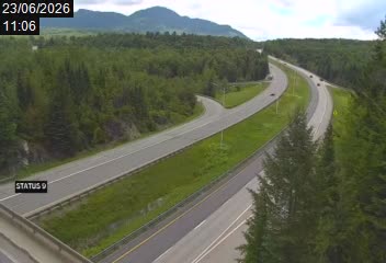
The Trans-Canada Highway (French: Route Transcanadienne) is a transcontinental highway system within the country of Canada. The system traverses all ten provinces of Canada, and the main route travels 7,821 kilometres (4,860 miles) between Victoria, British Columbia, and St. John's, Newfoundland and Labrador, making it one of the longest routes of its type in the world - Map - 
Whistler Resort, Whistler Village, British Columbia, Canada
(from
Tourism Whister)

Kicking Horse/Kinbasket Lake, Columbia-Shuswap, British Columbia,
Canada
(east view, from
Adamants Lodge/CMH HELI-SKIING)
Deep Cove, Vancouver, British Columbia, Canada
(From Paddler's Paradise)
Long Beach, Tofino, Vancouver Island, British Columbia,
Canada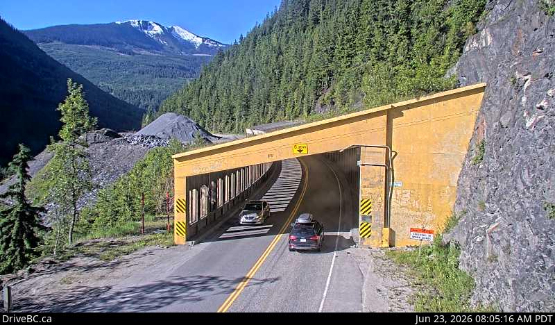
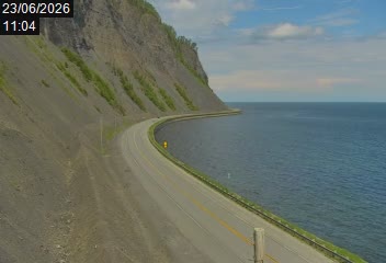
Trans-Canada Highway (Highway 1), British Columbia, Canada
(from Drive BC)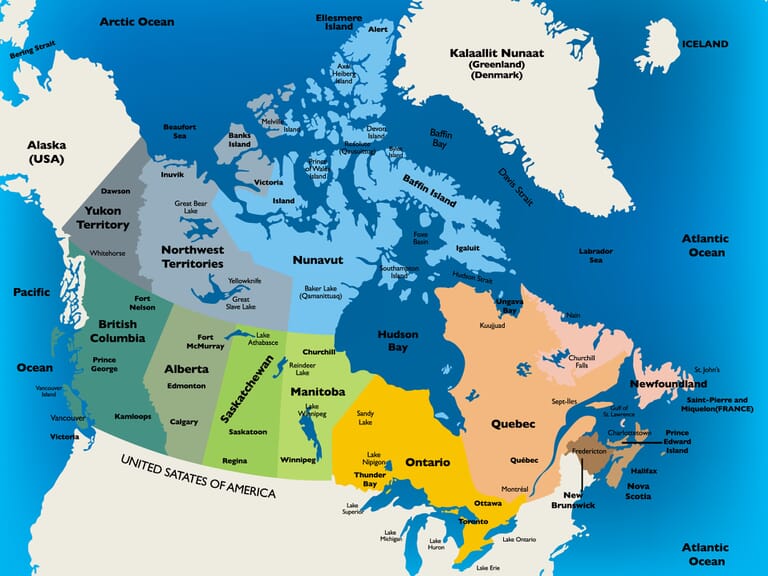
Worldwide Webcams Home Page
Colorado Web Cams
New York Webcams
New York City Webcams
Long Island Cams